

CalEnviroScreen Logo

CalEnviroScreen

CalEnviroScreen 5.0

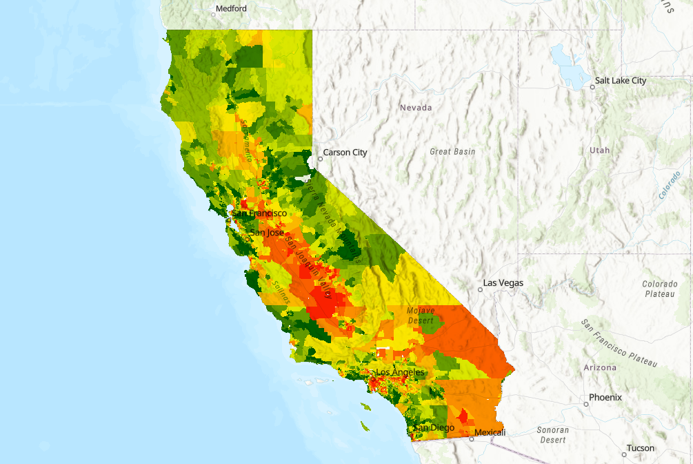
Explore how communities in your area may be disproportionately burdened by multiple sources of pollution in CalEnviroScreen 5.0.
View the Map


Contact Us

Didn’t find what you were looking for? Check out our FAQ page. You can also leave us a message using the form below or email us directly at CalEnviroScreen@oehha.ca.gov

View the CalEnviroScreen Contact Us page

Reports, Notices, Documents

CalEnviroScreen is a science-based tool that identifies the California communities most burdened by pollution from multiple sources and most vulnerable to its effects. Los Angeles Workshop.

Developed by the Office of Environmental Health Hazard Assessment (OEHHA) at the request of CalEPA, CalEnviroScreen is a science-based tool that identifies the California communities most burdened by pollution from multiple sources and most vulnerable to its effects. The tool will be used to help implement a state law (SB 535) that requires that 25 percent of the proceeds from the state’s cap-and-trade auctions be invested in projects that benefit disadvantaged communities, including 10 percent for projects located within these areas.

The tool uses data on 12 types of pollution and environmental factors and seven population characteristics and socioeconomic factors to create scores for each of the state’s 8,000 census tracts.

Background information on CalEnviroScreen 2.0, with links to press releases, data (i.e., maps of overall scores, pollution burden scores, population characteristic scores), and a link to a mobile-freindly map of the overall CalEnviroScreen 2.0 scores.

Feedback and comments on the draft CalEnviroScreen 2.0 document.