CalEnviroScreen Logo

CalEnviroScreen

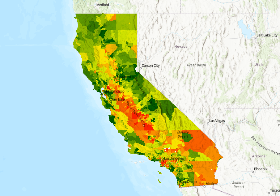
Draft CalEnviroScreen 5.0

Explore how communities in your area may be disproportionately burdened by multiple sources of pollution in our updated draft.

View the Map 

CalEnviroScreen Sample Map of the state of California


Contact Us

Didn’t find what you were looking for? Check out our FAQ page. You can also leave us a message using the form below or email us directly at CalEnviroScreen@oehha.ca.gov

View the CalEnviroScreen Contact Us page

Reports, Notices, Documents

Please see the new StoryMap on the 10-year anniversary of the first public version of CalEnviroScreen to learn about how the tool was developed, has improved over time, been used to advance environmental justice, and come to serve as a national model. In recognition of the collaborative process the informed the tool, the StoryMap contains numerous quotes from users of the tool and key people that have contributed their time, expertise, and opinions to help shape CalEnviroScreen over the years.

: CalEnviroScreen 4.0

New CalEnviroScreen 4.0 data dashboard released. The dashboard is an interactive online tool used for filtering and visualizing the latest CalEnviroScreen data. Users can filter CalEnviroScreen 4.0 data by geography (county, city, or legislative district) and by any combination of the results from the 21 indicators. A tutorial video and user guide are available. Also released is the response to public comments on CalEnviroScreen 4.0.

: Maps & Data

New CalEnviroScreen 4.0 data dashboard released. The dashboard is an interactive online tool used for filtering and visualizing the latest CalEnviroScreen data. Users can filter CalEnviroScreen 4.0 data by geography (county, city, or legislative district) and by any combination of the results from the 21 indicators. A tutorial video and user guide are available.

Disadvantaged Community Designation (May 2022)

Information on the uses of CalEnviroScreen