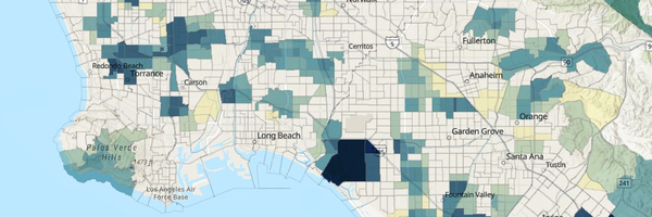
Pesticide Use
Exposure Indicator
Tracks the use of hazardous agricultural pesticides—chemicals that can drift into the homes and bodies of nearby farmworker families and residents.
What are pesticides?
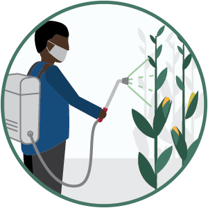
Pesticides are chemicals used to control insects, weeds, and plant or animal diseases. Over 1,000 pesticides are approved for use in California. They are applied to fields by air, by farm machinery, or by workers on the ground.
Why is it included in CalEnviroScreen?
- Farmworker families and people who live near agricultural fields can be exposed to pesticides, both outdoors and inside homes.
- Studies have found that people living in agricultural areas of California have higher amounts of pesticides in their bodies than other people.
- Exposure to high levels of some pesticides can cause illness immediately or conditions such as birth defects or cancer later in life.
How is it measured?
- The California Department of Pesticide Regulation (DPR) keeps a record of where and when agricultural pesticides are used through its Pesticide Use Reporting (PUR) database.
- CalEnviroScreen includes the most toxic pesticides that people may be exposed to that are used in California agriculture.
- The indicator adds up the total pounds per square mile of 124 selected pesticide active ingredients, filtered for both hazard and volatility, used in production agriculture, averaged over the years 2022–2024.
- The indicator only includes pesticides used on agricultural commodities and does not include non-agricultural use such as golf courses and residential use.